
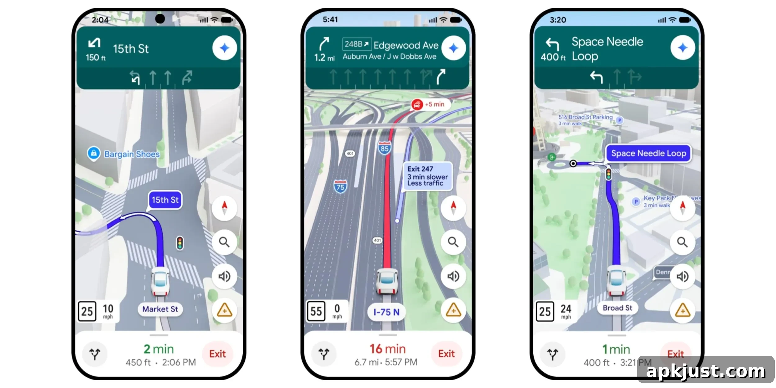
Google Maps is introducing what it calls the “biggest update in over a decade” to its driving experience: Immersive Navigation. This redesign focuses on clearer visuals and more intuitive guidance to help drivers navigate with greater confidence and situational awareness.
At the core of Immersive Navigation is a vivid 3D presentation that represents nearby buildings, overpasses, and terrain more realistically. The map view emphasizes important road details—lane markings, crosswalks, traffic lights, stop signs, medians, and other features—so drivers can better understand what’s ahead and make lane changes or turns with less uncertainty.
Google Maps rolling out conversational ‘Ask Maps’ chat
To help drivers prepare for upcoming maneuvers, Maps provides a broader contextual view of the route. Smart zooming and semi-transparent building overlays reveal the environment around complex intersections and multi-lane exits, highlighting the correct lane and showing how the road will change before you reach it. These previews are designed to reduce last-second lane changes and missed exits.
Voice guidance has also been refined to sound more natural and context-aware. Rather than simple turn-by-turn prompts, instructions can reference landmarks and specific exits—for example, “Go past this exit and take the next one for Illinois 43 South”—so drivers receive guidance that matches what they actually see on the road.
Underpinning these visual and spoken improvements is Google’s use of Gemini for spatial understanding. The models analyze up-to-date imagery from Street View and aerial photography to deliver an accurate depiction of route surroundings, making it easier to spot landmarks, medians, and other real-world features that affect driving decisions.
When considering alternate routes, Maps will explain trade-offs clearly—such as a longer drive with less traffic versus a quicker path that includes a toll. This helps drivers choose the route that best fits their priorities, whether that’s time, distance, traffic avoidance, or cost.
We’ll also alert you to real-time disruptions along your route, like road construction and crashes – powered by our community of drivers, who provide more than 10 million of these contributions every single day.
Before you start a trip, Immersive Navigation lets you preview your destination and its surroundings using Street View imagery. That preview can include recommended parking options near the destination, giving drivers a clearer sense of arrival logistics before they set out.
As you approach, Maps will highlight the building’s entrance, nearby parking, and which side of the street to be on—so you can go from the last turn to the front door with confidence.
Immersive Navigation begins rolling out today in the United States. Google reports that availability will expand over the coming months to eligible iOS and Android devices, as well as to in-car platforms such as CarPlay, Android Auto, and vehicles with Google built-in (Android Automotive). As rollout continues, more users should gain access to the enhanced visuals, improved voice guidance, and route-context features.
Taken together, these changes aim to make driving with Google Maps less about following abstract directions and more about understanding the actual road environment. By combining refined 3D visuals, more conversational guidance, route trade-off explanations, and timely disruption alerts, Immersive Navigation seeks to reduce driver stress and help you arrive at your destination more smoothly.